GeoSnaps - Image of the Day
Geologic snapshots capturing Arizona’s geologic setting and mining history with a picture of the day from 1 January through 31 December 2013.
Check out previous GeoSnaps/Images of the Day.

April 8, 2008 | McDowell Mountains | Maricopa County, Arizona
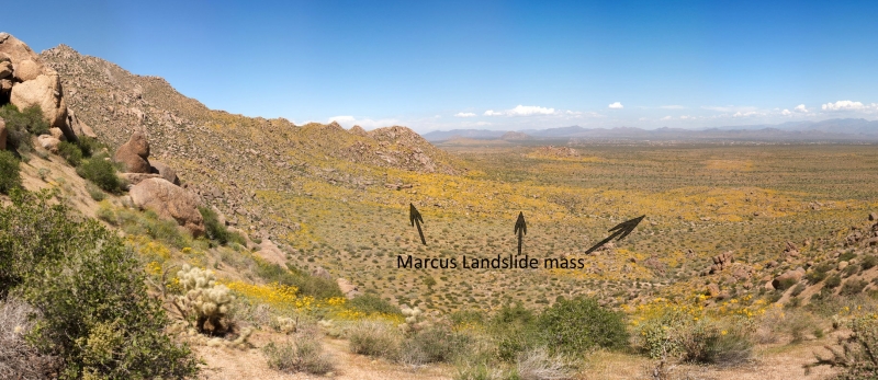
Panoramic view of the Marcus Landslide from a high ridge, looking north along the eastern flank of the McDowell Mountains. In this photo the East End peak is visible at far left, which marks the top of the landslide scarp, where the landslide removed a large portion of granite bedrock approximately 500,000 years ago. The slidemass of boulders, sand and clay rest at the base of the range as a long ridge of low relief, visible in the right half of the photo. The slidemass is accentuated by thousands of yellow-blooming brittlebush, which proliferate in the clay-rich landslide matrix. The Marcus Landslide was discovered in 2002 by Arizona State University graduate students while mapping in the area during the blooming season, which no doubt helped to highlight the subtle geologic feature. | Photo by Joe Viera.

