GeoSnaps - Image of the Day
Geologic snapshots capturing Arizona’s geologic setting and mining history with a picture of the day from 1 January through 31 December 2013.
Check out previous GeoSnaps/Images of the Day.

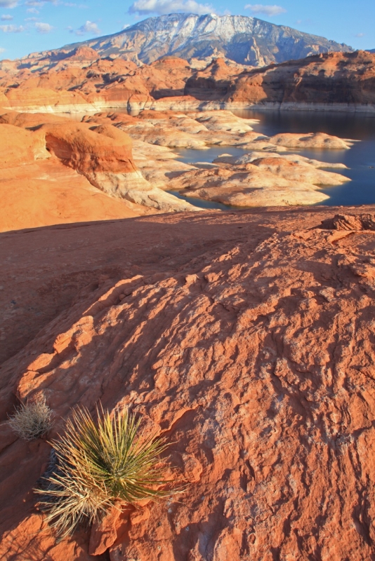
March 3, 2013 - Winter sunlight bathes the Jurassic Navajo Sandstone on the shores of Lake Powell, a reservoir on the Colorado River behind Glen Canyon Dam. The cross-bedding in the Navajo originated in giant dune fields in a vast Sahara-like desert. The sand grains were ultimately brought into the southwest by wind from Wyoming and Montana, but were originally transported in rivers from western Appalachia. The evidence comes from tiny zircon crystals found within the quartz sand. In the distance, snow mantles Navajo Mountain (elev. 10,388 ft or 3,166 m) located on the Utah/Arizona state line. This mountain is known as a laccolith and formed as magma squeezed sideways through buried strata, rather than erupt vertically onto the surface. The Colorado Plateau has numerous laccoliths including the Carrizo Mountains (Arizona), Sleeping Ute and La Plata mountains (Colorado), and the La Sal, Abajo, and Henry mountains (Utah). All were erupted between about 28 and 20 million years ago.
By Wayne Ranney - Lake Powell Arizona and Utah (photo shot in Utah but the Arizona state line goes through the right hand flank of Navajo Mountain).

